And this opportunity came as part of a surprise to my wife on
account of our wedding anniversary. I did the booking at MTDC last month and
told her about the plan to celebrate this Anniversary Weekend somewhere outside
Pune; however she was unaware of the venue (finally, I told her when we were 23
kms prior to Bhandardara).
We started off from Pune at 6.45 am and took the NH-50 (Pune-Nashik Highway).
There are many routes to reach Bhandardara. The most common is from Sangamner [संगमनेर] and another one from Bota [बोटा] (just after Ale-Phata [आळे-फाटा]). There is one more (much
longer) from Ale Phata and ahead of Malshej Ghat. All these routes are shown by
Google Maps. However, I am not sure of the 3rd route from Malshej
Ghat [माळ्शेज घाट].
I came across a much shorter route on one of the Team BHP blogs –
Pune-Narayangaon-Ozar-Otur-Brhmanwada-Kotul-Rajur-Shendi(Bhandardara).
 |
| The Route |
This costed me about 176 kms (the shortest among other 3 routes
mentioned above).
The drive was interesting. Small road turning through the fields
on both sides, crossing over the hillocks through ghats. I enjoyed the drive.
It was different than the mundane highway driving. It gave me the feeling of
driving through the Western Ghats in Konkan.
Just after Narayangaon [नारायणगावा] on NH-50 there is a left turn to Ozar [ओझर] (Ashtavinayakas). We reached Ozar by 8.15 am. After a peaceful darshan of
Vighneshwar [विघ्नेश्वर] and a breakfast, we cooched towards Otur [ओतूर]. At Otur we enquired for
Brahman-wada [ब्राह्मण-वाडा]. The road goes straight ahead of Otur ST Stand.
 |
| Ojhar - Ashtavinayak |
 |
| Ojhar - Ashtavinayak
|
At Brahman-wada, there is a “T” junction. Right will go back to
NH-50 (Bota). We took Left. Then came Kotul [कोतुळ] and further ahead came Rajur [राजूर].
Ahead of Rajur there comes ascend towards left at Randha [रंधा] village
(sign boards of MTDC and Anandvan resorts are available). This road goes to the
village called Shendi [शेंडी] or Bhandardara.
Just before this ascend there is descend on Right towards Randha
Waterfall. One can visit this before moving ahead. This will save your time of
coming back again. Or else plan this while going back home.
Good amount of signage and boards are available for MTDC resort.
The road goes through the Power Station, PWD Residential Colony, the Dam wall,
Overflow gate, small bridges, etc. There are lots of Nilgiri Trees on both
sides of roads. Large numbers of Bats are seen flocked on the branches of these
trees all the day.
Sometimes in monsoon, the road near the overflow gate of the dam
is completely under the water and hence is blocked. In this case, one needs to
go straight ahead of Randha village (don’t take the Left ascent). Need to
enquire to locals for the further way.
With 45 minutes break at Ozar we reached MTDC at 12.15 pm (4.45
hours / 176 kms).
We had booked Lake View Cottage. There were two rooms (a living
room and a bedroom with attached toilet). Additional mattraces were available
apart from a double bed and a sofa set in the living room.
As the one at Ganpatipule and Malshej Ghat, this MTDC also scores
for its location. Our cottage was just next to the lake. View from the verandah
and the window was superb. I could see the beautiful lake in the front and
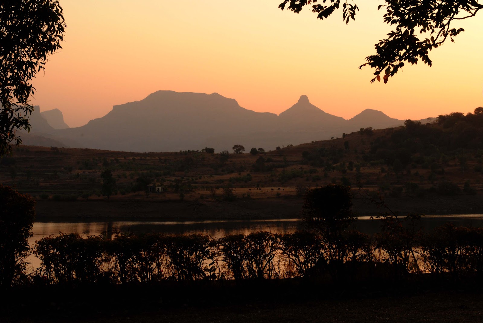
complete Sahyadri Mountain Range at the background. I could see the fort Ratangad
exactly opposite. In the evening we watched the Sun setting in front of us. 100
marks for the location. This view is not available to other resorts in the area
(Yash Resort – 5000 Rs a day and Anandvan Resort – 10000 Rs a day).
The view:
It’s a no-frills place; basics only are available.
Room service is available with a 10% extra charge à Very bad!!!
Toilets were exceptionally clean.
Load shedding is a problem. When we reached our room, there was no
electricity. Generator starts at 3.00 pm (???). Surprisingly, the ambient
temperature was much cooler inside the room as compared to outside. At night we
came to know that the fan is not working, tubelights have gone off. We complained,
an electrician arrived, he tried to fix the problem; but in vain.
Food when we ordered in the afternoon was awesome (Veg Thali);
however when we tried Punjabi Dish in the evening, it was pathetic. Breakfast
(Omlet) and tea next morning was again – awesome.
I had heard that Guides are available near MTDC who take you
around the place. We met one such person while checking in our room. I took his
contact details.
After a brief nap in the afternoon, we called up that Guide –
Vijay. We fixed up a rate of 400 Rs. for two days. There are two ways for
sight-seeing – a short 22 kms to-and-fro for Wilson Dam, Arthur Lake, Over-flow
Gate and Randha Falls AND a longer 55 kms to-and-fro around Bhandardara Dam
catchment area (Arthur Lake).
We left at 4 pm for the shorter route first. We visited through
the same route while coming from Pune some time back.
Wilson Dam: Named after a British Governor of the region. Built
some time during 1910; construction took about 16 years to complete. It is
built on Pravara [प्रवरा] River (also known as Amrutvahini in the
region). The water catchment area is as wide as 25 kms and as deep as 260 feet.
 |
| Wilson Dam wall with Umbrella Falls on right |
Umbrella Falls: When one of the sluice gates (on the Right
side of the wall) is opened, the water that gushes out forms a shape of the Umbrella
due to the shape of the rock below. Hence the name. It is visible in monsoons
or when the dam gates are opened as per the irrigation requirements during the
year. (our bad luck – the gates were opened just 2-3 days ago)
Arthur Lake: Named after the architect of the dam. It is
the water body that is formed due to the catchment of Wilson Dam. Boating
facilities are run by locals here. The sight of this lake surrounded by Sahyadri Mountains all around is mesmerizing.
Over-glow Gate: Little ahead of the Main Dam Wall, are the
Over-flow Gates. These radial gates are used to maintain the required water
levels. In monsoon, these gates are opened to its limit and still water
overflows from the adjust walls passing through the bridge and road. This
causes the blockage of road.
Randha Waterfall: Pravara
River ahead of this dam
descends roaring down into a beautiful gorge forming a Waterfall. Named after
the village nearby. It is one of the leading waterfalls in India. It is
available all-year-round. However the intensity in monsoons is magnanimous.
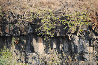 |
Honey-combs on rocks at Randha Falls; Tribals climb down
towards them to collect honey |
By 6.00 pm, we reached our cottage. Watching the Sun set from your
verandah is an awesome sight. Though the Sun sets everyday, you cannot witness
it in your cities.
Next morning, we checked-out from MTDC at 9.00 am after our
break-fast. We started off for the drive around the Bhandardara Dam. We again
took the same road as yesterday till the Over-flow Gates. Then there is a Right
towards Amruteshwar [अम्रुतेश्वर]
Temple. This road comes
under Forest Department surveillance. This is to avoid people from entering
into hunting activities. One can find Rabbits, Foxes, Wolves and Leopards
inside. Actually the area is the part of Kalsubai –Harishchandragad WildlifeSanctuary.
There is charge of Rs. 50 per vehicle and Rs. 20 per person. However, if you
visit the place before the schedule timing of the watchman’s arrival, you can visit
inside without any ticket.
This drive is excellent. Small road turning in the forest covered
with lush green trees; wheat fields were seen all around. Dried leaves were
gushing behind due to speeding car wheels and watching this from rear view
mirror of my car was priceless.
This road is around the lake with Sahyadris on to the left. We
moved ahead of the village named Mutkhel [मुतखेल]. By 10 am, we reached the Amruteshwar Temple
in the village of
Ratanwadi [रतन-वाडी]. This is at the
base of the fort Ratangad [रतन-गड].
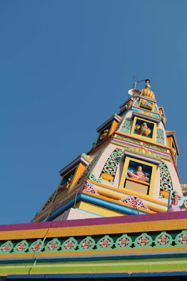
Amruteshwar is the Shiva
Temple built in
Hemadpanthi style of architecture using black stone. It is about a century old. Some say that it
is built in the era of Pandavas. References aside; the piece of art is awesome.
Carvings inside and outside is beautiful. The black colored sculpture with a
saffron flag flying on its top and the lush green back ground behind, makes
this temple stand out as a Jewel in the area.
 |
| Amruteshwar Temple |
 |
| Shiv-linga |
 |
| Sculptures inside |
This temple can also be reached through boat from Bhandardara.
It’s about an hour’s ride and then a walk till the temple. This walk depends
upon the water levels. We were told that we would need to walk about 3-4 kms (1
½ hour) as the water levels are low.
Near the temple is the Jal-Kund [जल-कुंड] (Water Tank); again of black stone
with carvings on it.
From here we moved ahead along the base of Ratangad. On our left
was the grand fort of Maratha Empire while far away on right on other side the of
lake I could see the tall peak of Kalsubai [कळसुबाई]. Leaving behind the village by the
name Saamrad [साम्रद], we reached towards Kokan-Kada [कोकण-कडा] (not to be mistaken with the one on
Harishchandragad [हरिश्चन्द्रगड]).
 |
| Ratangad |
This is a place near Ghatghar [घाटघर] dam with no signs or boards around.
It was the Guide with us hence we could trace it out. Else it is very difficult
to identify the location. Locals might know about it; only there should be
someone available to ask; we didn’t find anybody nearby.
This is place with “V” shaped rocks on both sides. Through which
you can see a dam below – Chonda [चोन्दा] Dam. The view is beautiful; with strong winds
flowing through.
The fun part is, the dam at the bottom is in Thane District. We
were actually standing on the border of Ahmednagar District. Mumbai from here
would be very close by. However, sadly, there is no road-route available yet.
 |
| Kokan-kada |
From here, we moved ahead around the Ghatghar Dam walls towards
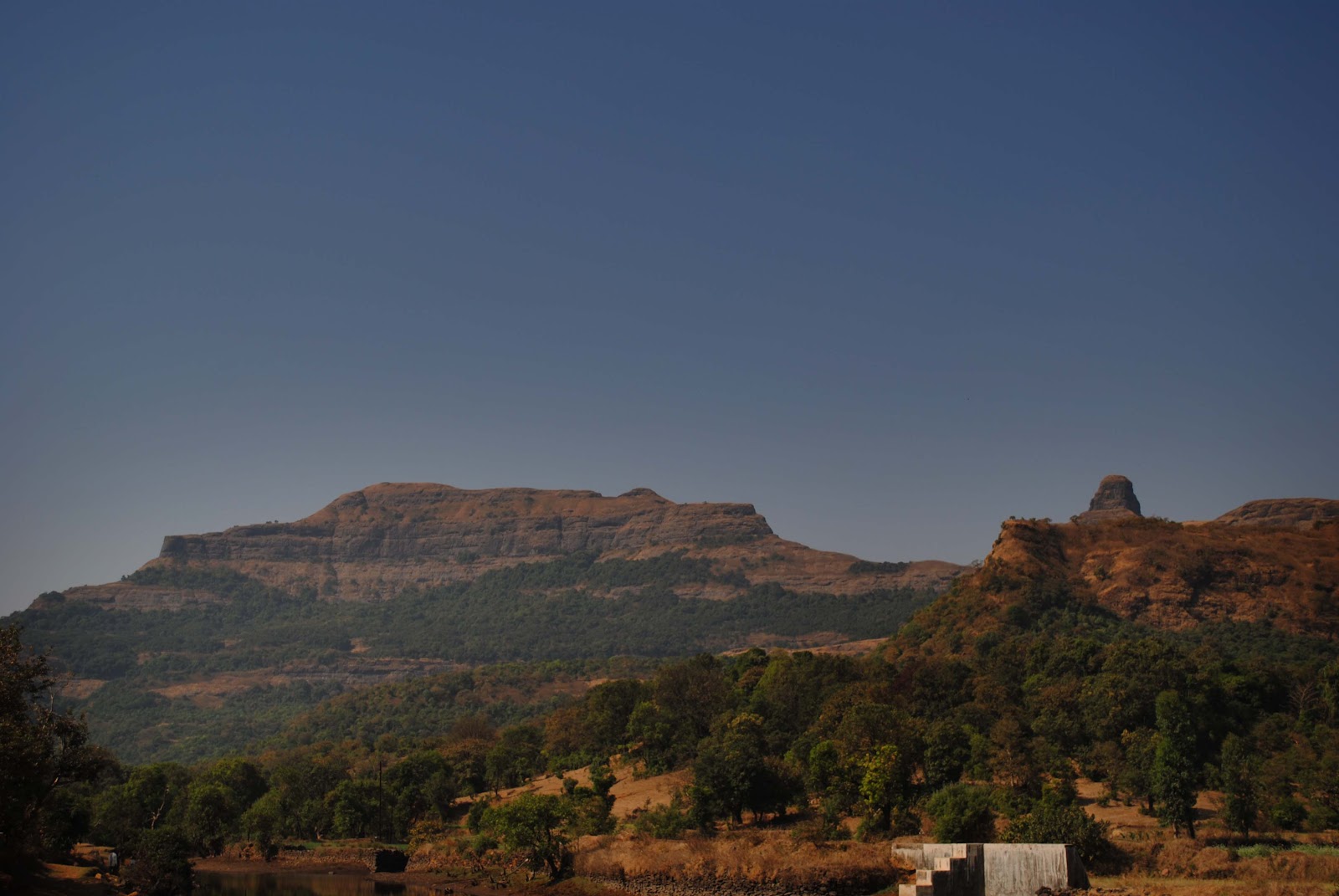
Panjare [पांजरे] village. This is the base village for Mount Kalsubai.
From here the Maharashtra’s tallest peak
stands tall (1646 meters / 5500 feet above seal level) just next to you. You
can see the red dot of the temple on the top of the peak.
 |
| Mount Kalsubai |
From here we moved ahead towards our base camp, MTDC. We reached
back by 11.30 am after completing a full circle of about 55 kms around Bhandardara Lake. Our route was
Shendi-Mutkhel-Ratanwadi-Saamrad-Ghatghar-Panjare-Shendi.
When enquired at MTDC Canteen for lunch, it was not yet ready
(lunch starts at 12). Nothing else was available to eat. We therefore had lunch
at hotel nearby – Sonali. There is one more by the name Vaibhav. I had heard
that these two serve good rice plates (Veg/Nonveg). Sonali was definitely good.
But I felt it was costly at Rs. 70 per plate.
By 12.30 pm we started our way towards Pune. This time we decided
to take the more busy and common Sangamner route. There is a Left just after
Rajur towards Akole [अकोले]. This road meets the NH-50 (Pune-Nashik Highway) at Sangamner.
By 3.15 pm we were at Daulat drinking Watermelon Joice and by 6.30
pm, we were at the comforts of our home.
Coordinates of the place: 19° 33' 08.00" N 73° 45' 20.66" E
Day 1:-
0 kms Pune (Narayan
Peth)
13 Nashik Phata
24 1st Toll Point on NH-50
(Near Chakan)
43 2nd
Toll Point on NH-50 (Near Rajgurunagar)
46
Rajgurunagar
66
Manchar
80
Narayangaon
91
Ozhar
100
Otur
116
Brahman-wada
133 Kotul
152 Rajur
166 Take the ascent
on Left (look for boards of Anandvan and MTDC Resorts)
176 Shendi village
(Bhandardara)
201 Sight-seeing at
Bhandardara – Wilson Dam, Arthur
Lake, Randha waterfall -
total of 25 kms
Day 2 :-
257 Sight-seeing at Bhandardara –
Amruteshwar temple (at Ratanwadi), Kokan-kada, Ghatghar dam, Kalsubai peak
(base village) – 56 kms (around the Arthur lake)
281 Rajur
285 Take Left towards Akole, Sangamner
302 Akole
325 Sangamner
362 Daulat Restaurant (on NH-50)
476 Pune (Narayan Peth)