There goes one Ladakhi Saying, “Only the best of friends and
fiercest of enemies visit this barren land”.
Visiting Ladakh is always associated with some type of an
aura around it. It’s said to be an Epic Journey. And covering this region on a
bike makes it even more adventurous & exciting. With roads that open up for
only few months of the year, these 2000 kms give you an experience of a
lifetime.
Ladakh is known for its Culture. Countless numbers of
Stupas, Prayer Wheels, Monasteries & vibrantly colorful Flags hanging all
around the houses, shops & temples tell that you are in the Land of the
Lamas.
 |
| Ladakh Flags |
 |
| Stupa |
The route we took was Jammu – Srinagar – Kargil – Leh –
Nubra Valley (Diskit) – Pangong Lake – Manali – Ambala. Total riding of about
2000 kms in 11 days.
The main highlight of this whole ride is the changing
landscapes. So much frequent sometimes, that they change after every 10-15 kms.
From lush green pastures of Kashmir Valley to raw form of nature with barren mountains
in Ladakh. Just couple of hours from Sonamarg, all civilization as if just
vanished. The only view that follows in the whole trip is the Snow on top of
the passes & Snow-clad Mountains at the horizon. These landscapes come in
all form of colors, textures, appearances. Mountain & rock colors change
from Grey to Violet to Green to White & Brown.
 |
| Kashmir Valley - first view after Jawahar Tunnel |
 |
| Sonamarg |
 |
| Ladakh |
The road coils through the hills moving through numbers of
passes (called as “La” in Ladakhi language). Zoji La, Fotu La, Khargung La,
Chang La, Baralacha La, etc. are to name a few. These passes basically connect
two regions / areas; e.g. Ladakh with Kashmir Valley & Leh with Nubra Valley.
All during the trip, the roads always keep company with the rivers of the
region. Starting with Tawi near Jammu, Chenaab on the way, Jhelum at Srinagar,
further followed by Sindhu (Indus) in Sonamarg, Saru at Kargil, Shyok in Nubra
Valley and finally Beas near Manali.
The road comprises of varied range - from a 4 lane highway
to “no roads”. Mostly single lane, these roads are a mixture of ghat sections
with multiple hair-pin bends, muddy – dusty roads, water logged at many places
due to melting snow, causes heavy sludge at some places. There are few water
crossings with slippery stones beneath. A slight misjudgment and there are
chances of slipping the bike. And all this with a deep valley on one side and
fear of a possible land-slide over other. It is very rightly said “Difficult
roads often lead to beautiful destinations”.


Indian Army through its BRO (Border Roads Organization) has
done an extremely commendable job in building & maintaining Roads in this strategically
important area.
For us, it all just started during a School Friends’ Get-together
& the idea of a Bike trip to Ladakh was conceptualized.
A mixed group of 6 was formed. And after an introduction
meet, plan was drafted, bookings were done & shopping was completed
(Clothing, Saddle-Bags, Protective Gears & Medicines).
We decided to send our bikes through train till Jammu.
Option of road transport is available. Chances of bikes getting damaged, is
equal for both the options. Train has an advantage of faster transport &
cheaper (by about 1000 Rs.). However, train has its own issues of Govt. bureaucracy
and no parcel tracking system.
We sent our bikes from Pune Station on May 23, 2016; just to
be on a safer side so that our bikes would reach at least before 27th
to be available for us on 28th. Normal Pune-Jammu journey takes 2
days by Jhelum Express.
May 27, 2016:
We boarded 11.30 am flight to Delhi from Pune. Reaching
Delhi Airport, we moved towards New Delhi Station through Airport Metro
Service. And laid ourselves on the Platform awaiting for our evening train
(Jammu Rajdhani at 8.40 pm).
May 28, 2016:
We reached Jammu early morning at 6.00 am. Deliveries at
Parcel Office open at 9.30 am. Till the time, we freshened up at the Waiting
Room. It takes lot of time to get the bikes ready actually (& we don’t
consider it while planning).
We got our bikes; we unpacked them, got to a nearby Fuel
Station to get Petrol in Bottles and mounted our baggage on them. All our bikes
were received in fairly good condition. Minor damages – one had small dent on
Fuel Tank, other had its Brake Lever bent, Front Mud-guard bent while another
had its Battery Water leaked out damaging the Paint.
Finally, when we were good to go, it was 12.30 pm. Actually,
we had planned that we would start by 10-10:30 & were aiming for first stop
at Srinagar (300 kms away). But now we decided to postpone by a day & have
a night-halt somewhere in between (Patnitop, maybe).
This was the time; we started our dream journey. After a
brief photo-op, we headed towards Fuel Station for a Tank Full. And then we
headed on the NH-1 towards Srinagar.
 |
| Such bikes are available on rent from Jammu, Srinagar & in Ladakh |
The road till Srinagar was completely known to me, since I
had been through this less than a year ago (my Vaishnodevi Trip in July 2015).
However, the difference this time was the self-ride. The whole route is heavily
polluted with trucks plying continuously.
Road till Udhampur (50 kms) is a complete 4 lane highway
(Toll Road – free for bikes) with 4 tunnels in between. It is recently
constructed. Once after Udhampur, the fun starts. Road from here onwards is a
complete ghat – single lane, no dividers.
Ahead of Udhampur, we stopped for lunch at a hotel by the
name Hotel Tawi View. We had planned to halt at Batote which is about 25 kms
ahead of Patnitop. By the time we completed our lunch, it was 3.30 pm & we
had only 60 kms to go till Batote. We were planning to reach our night-stay by
5 pm.
However, today’s day was destined to falter all our plans. We
started to move & suddenly, it started raining heavily with thunderstorm. Hot
climate at about 30 deg suddenly changed within span of 15 mins. By the time we
could understand anything, we were wet by the core. So we decided to just be
& move on without taking out our rain gear (which was off-course packed at
the bottom most portion of our saddle-bags).
Instead of 5, we reached our hotel by 7 pm. Thunderous rains
on the very first day of our ride actually made us into jitters. We were really
worried. The nature showed its fury just in the beginning & 13 more days
were still to go!!!
Ride of the day: 125 kms; Total: 125 kms
Route: Jammu-Udhampur-Patnitop-Batote
May 29, 2016:
Next morning, however, was completely cleared of any dark
clouds. It was clear skies & bright sunlight.
We had planned to leave by 7 am. However, we actually
started by 8.15. However, today’s journey was a relaxed one; with 175 kms to go
till Srinagar. Just ahead we witnessed our first rough road patch. The
construction work was in progress at the Chenani-Nashri Tunnel or Patnitop Tunnel site.
We took a break at Peerah. The place is famous for its
Rajma-Chaaval in Desi Ghee. The ghee actually flows over the Chaaval. We had
this during our last year’s visit at the same hotel.
After this divine breakfast, we started ahead with a plan to
break at the iconic Jawahar Tunnel. Driving through this Tunnel is an
experience; driving at a slow pace behind some bigger vehicle on this single
lane road of about 2.5 kms. This opens up into Kashmir Valley. It is, thus,
gateway to the Paradise on Earth.
 |
| Rajma Chaawal in Desi Ghee @ Peerah |
Road ahead is now fairly straight finally ascending to
plains till Srinagar. In between there is a place called Green Tunnel. It’s a
natural tunnel like formation due to tall Poplar Trees on both sides of the
road. We had our lunch somewhere nearby - Lakshmi Vaishno Dhaba.
After crossing Saffron (Kesar) Fields of Pampore, Awantipura Ruins, Bat
Factories of Sangam, we finally reached our destination for the day – Srinagar.
We reached our Hotel Malik Palace, just opposite Dal Lake,
parked our vehicles, unpacked luggage & it started raining heavily. Again
the climate changed in a span of 15 minutes (like yesterday).
By the time we freshened-up, the heavy rain normalized into
a drizzle. It was again an experience to roam around on the Boulevard Road with
Dal Lake by the side & watching the Sun set behind snow clad mountains.
Ride of the day: 175 kms; Total: 300 kms
 |
| Dal Lake, Srinagar |
 |
| Dal Lake, Srinagar |
Route: Batote-Peerah-Ramban-Jawahar
Tunnel-Qazigund-Anantnag-Srinagar
May 30, 2016:
We started off by 7 am. After petrol fill-up, we moved for
Kargil. From here onwards, it was a new route for me. We missed one turn; but
this miss led us to a scenic circle. We encircled the complete Dal Lake – ride
of about 22 kms. With the Lake on the left & scenic beauty all around, the
ride was heavenly – various gardens of Srinagar, Shakaracharya Hill, Hari
Parbat, Hazrat Bal and off course snow clad mountains.
Ahead of Gandarbal on the banks of Sindhu River (Indus), we
had our breakfast – Punjabi Dhaba. As we were moving towards Sonamarg through
the road along the banks of Indus, snow-clad mountains started appearing
nearer. And we had our first closest view of snow of the trip. We were sure to
have many more such occurrences ahead.
Sonamarg (means Meadow of Gold) at above 9000 feet is one of
the main attractions of Kashmir Valley. This is a drive through Sindh Valley
with a backdrop of Green & White Mountains. This is the last time we saw
lush greenery around. Ahead of Sonamarg is Zoji La, a vital link between Ladakh
& Kashmir. Zoji La greeted us with muddy roads having twists & turns.
The drive opened-up the vista of what lies ahead.
 |
| Sonamarg - Meadow of Gold |
As we started climbing the Pass gradually, the temperature
started to drop & the snow started to appear nearer. As the top approached,
the roads started worsening. Water loggings, rough road patches, slippery mud,
loose gravel were tasting durability of our bikes. Zoji La top at 11000 feet
was covered with snow walls on one side while deep valley on other. At points,
these snow walls were also on both sides and as tall as 30 feet. During peak
winters, snow fall here is till 60 feet.
 |
| Road to Zoji La |
 |
| Road to Zoji La |
 |
| Road to Zoji La |
 |
| Zoji La Top |
 |
| Zoji La Top |
After ascending Zoji La, there is an Army check-post at
Gumri. Army canteen is open to civilians as well – Samosas, Momos, Maggi, Tea.
A chat with a soldier there gave us an insight under which the Indian Army
operates. During peak winters, the whole NH-1 is closed to vehicular traffic.
The Army even dismantles all the bridges to avoid in enemy intrusion, since the
Army Posts are vacated.
After about 40 kms of Zoji La terrain, there is an entry
post at Kargil District. Basic info about the Bike, its rider & License
Number is noted down. Ladakh region starts after Zoji La & Kargil is the
gateway for it. We took about 8 hours to cross these 120 kms so far with just a
heavy breakfast in the morning.
20 kms more & we reached Drass, said to be 2nd
coldest inhabited place in world. Average Low Temperatures go till -22 deg C
with record low of about -45 deg C. But main attraction here is the Kargil War
Memorial, about 15 kms ahead.
Kargil War Memorial (or Vijay Path) was the patriotic moment
of our whole trip. Built at the foot of Tololing Range, it brought goose-bumps
in stomach by just thinking how our soldiers got back our land from enemy under
challenging climatic conditions. The Memorial was constructed in Nov 2004 to honor
our Soldiers who fought & won us the Kargil War & few of them who lost
their lives in doing so. The place was so selected because Drass Sector was the
sector where major part of War was fought. The area is surrounded with major
peaks Tiger Hill, Rhino Horn, Point 4875 (Batra Top) & Tololing. These are at
such a dominant position which overlooks the strategic Srinagar-Leh Highway.
 |
| Drass - 2nd coldest inhabited place in world |
A massive Tricolor furling on high mast attracts the attention,
with a flame burning at its feet 24x7. The wall behind is engraved with names
of Soldiers who laid their lives for the country. Manoj Pandey Gallery houses
number of photos & information on the war; and also the Pakistani items
captured (Ammunition, ID Cards, Currency Notes, Helmets, etc). Walking down the
Vijay Path bring tears in the eyes as you see one sentence written in front –
“When you go home, tell them of us… and say that for your tomorrow, we gave our
today.”
The Memorial is maintained in such a way that our heart
fills up with pride. Every season, one Battalion is entitled the responsibility
of maintaining the area. They also tell visitors the brief history of Kargil
War (about 10 mins.). Many videos are available on YouTube.
 |
| Vijay Path - Kargil War Memorial |
 |
| The Memorial |

We had decided to spend not more than 15-20 minutes here as
we felt we were getting late. However, we ended up spending 1 hour 15 mins
here. After an hours’ drive or so, we reached Kargil. It is a small town
located on the banks of Suru River (a tributary of Indus). Kargil is 2nd
largest town in Ladakh after Leh. We reached our destination, Hotel D’Zojila at
6 pm.
There was a Car Service Station opposite our hotel. We got
our bikes washed in the evening for the exciting rides ahead.
 |
| Kargil Town - by the banks of River Suru |
Ride of the day: 220 kms; Total: 520 kms
Route: Srinagar-Sonamarg-Zoji La-Dras-Kargil
May 31, 2016:
Again we started off at 7. Crossing over the bridge on River
Suru, we started to ascend the hillock. View of Kargil town with Suru flowing
in front was a view to enjoy. We filled-up the petrol & marched ahead. Our
breakfast stop was decided at Mulbekh, about 40 kms. However, the road in
between was bad - dusty with water loggings.
By 9 am we reached Mulbekh, which houses a Chamba Statue (of Standing
Buddha). Little ahead of Mulbekh town towards Leh, on your right is a large
rock. On this rock, the Buddha is carved. Actually it can be very easily seen,
but it is located on a turn & hence can be very well missed. One of our
friends missed this, then to wait for us 30 kms ahead.
The location is very scenic, with blue sky, barren mountains
& greenery at their feet.
 |
| Standing Buddha - Mulbekh |
 |
| Enter the Ladakh |

 |
| Namika La - Panorama |
 |
| Fotu La |
 |
| Fotu La |
 |
| Lamayuru Monastery |


As we entered Ladakh, children walking / playing on the
roads come forward a “high-5”, a clap as we whizz past them on bikes. Sometimes,
they do come dangerously close. Just need to be careful & slow down a bit
near villages. We had purchased some biscuit packs for gifting them to the kids
on the way.
We moved ahead at 2 pm.

The area around Lamayuru is known as Moonscape or Moonland. It is said to have resemblance to that Landscape on the Moon. We asked the hotel owner about it. And he said, “it is just behind the hillock”. Lamayuru Monastery is known for its landscape resembling that on Moon.

The area around Lamayuru is known as Moonscape or Moonland. It is said to have resemblance to that Landscape on the Moon. We asked the hotel owner about it. And he said, “it is just behind the hillock”. Lamayuru Monastery is known for its landscape resembling that on Moon.
As we were cruising ahead, first time we saw different
color-shades in rocks & mountains. It started with Violet; so much so that
the shade was appearing in the road below. Maybe they use the same rocks &
gravel to construct the roads. Then over the days, we could identify colors
ranging from Green, Grey, Blue & even Orange.
We had heard that in Ladakh, landscapes change every 10-15
kms. We were experiencing that. Apart from colors, there were changes in
patterns, textures & formations.
 |
| A Tinge Of Voilet |
On the way ahead there is another nature’s beauty near the
place called Nimmu (80 kms ahead of Lamayuru). There is a confluence of two
Rivers – Indus & Zanskar. The place is so beautiful, that the two rivers
are very clearly distinguished by the colors – Grey Zanskar merging into Green
Indus. The view below, from the road by the top-side is spectacular.
Just 5 kms is the wonder moment, the famous Magnetic Hill of
Ladakh. It is actually a demarcated spot on the highway. Here the vehicles when
parked with engine switched-off & brakes released, they tend to move uphill
(ascend). Actually, there is nothing magnetic in it. Even when water is poured
on the road, it flows upwards. This is an optical illusion created because of
the topography of the region & absence of clear horizon; without horizon,
judging the slope is difficult as reference is missing. What seems to be an uphill
is actually a downhill.
It was 5 pm when started for Leh. On the way is a renowned
Gurudwara Pathar Saahib. We skipped this since we wanted to reach Leh in time.
By 6 pm we were inside Leh town. After a cup of tea, Maggi & Momos, we
started towards the search for our Hotel. Finally, by 6.45 pm, we reached our
Home-stay, Lingtse Guest House.
The night was chilly. It was our first chilly night of the
journey. Temperature might had gone 4-5 degrees sub-zero.
 |
| Road to Leh |
Ride of the day: 231 kms; Total: 751 kms
Route: Kargil-Mulbekh-Fotu La-Lamayuru-Nimmu-Leh
June 1, 2016:
Today was the rest day at Leh. Day kept for acclimatization
for the tough rides ahead. Site-seeing was optional plan. There are many places
to see in Leh – The Leh Palace, Hall of Fame (Army Museaum). We however, just
visited Shanti Stupa. Since it is located at the top of the hillock & we
were seeing it since yesterday when arrived in Leh and since it was near to our
Guest House. Afterwards, we went to the main market for some shopping.


Shanti Stupa is the highest place in the whole Leh town.
Panoramic view of Leh from here looks amazing. It was constructed by Japanese
Buddhists – construction started in 1983 & completed in 1991. Access here
is by 500 steps as well as vehicular road. It is a famous tourist attraction at
Leh due to its architecture, religious significance & spectacular views.
Post lunch, we came back to our rooms for another round of
rest. Evening, we spent with some planning for rides ahead. Then we went to
fill-up our bikes, had dinner & returned for good night’s sleep.
 |
| Shanti Stupa |
 |
| Shanti Stupa |
 |
| Leh Town Panorama - A View from Shanti Stupa |
Leh town was the erstwhile capital of Ladakh region, today Leh district is the 2nd largest district in India after Kutch, Gujarat. It’s a bigger town after Srinagar. It houses a large market area and almost everything is available. All hotels, guest houses, home-stays & even restaurants are equipped with Wi-Fi; which free for its patrons.
Ride of the day: 7 kms; Total: 762 kms
June 2, 2016:
We started early today, by 6.30 am. This was to avoid the
“Aircraft Tourists”. It’s a phrase for the tourists who land in Leh by flights
or Taxis, take couple of day’s rest & then start for Nubra Valley &
Khardung La in the morning. We wanted to avoid their rush.
The road to Nubra Valley goes through Khardung La, said to
be word’s highest motorable road at 18,380 feet. Khardung La Top is about 40
kms from Leh. There are three check-posts in between – one Taxi Union CP while
two Army CP (South Pullu & North Pullu). Self-declaration Form has to be
submitted at these CPs. This is for security & safety of tourists, in case
of any emergency. Forms are available at Hotels in Leh.
30 kms road of pass between South & North Pullu was difficult. We were on this road between 8 am to 10 am. Actually, water from melting snow had accumulated in potholes on road. And that water had turned into ice / snow overnight. This was causing our bikes to skid, if went over them. However, the view was awesome.
 |
| Enroute Khardung La Top |

As we started descending down, the view of bluish-green
waters of Shyok River flowing in multiple streams below was divine.
As we
started negotiating turns & got down to plains, we reached the village by
the name Khalsar. From here there is a road towards left to Diskit, 20 kms
ahead. Here onwards, the landscapes changed. Rugged barren mountains &
rocks changed into desert & sand dunes. It felt as if the mountains around
are formed just of the loose sand pored over.
There is a Buddha Statue on a small hillock just at the
entrance of Diskit. It also has panoramic views. We, however, skipped it as we
had to move ahead to Hunder.
 |
| Descending Khardung La - Magnificient Shyok River in the background |
 |
| Desert Landscapes - Nubra Valley |
 |
| Hunder Sand Dunes |
 |
| Double Humped Camels (Bactrian Camels) |

There is another fascinating place ahead – Turtuk. It is the
northern most village of India; that last out-post. Ahead of Turtuk starts the
Pakistan controlled Gilgit-Baltistan areas. Another distinction is that, Turtuk
was under Pakistan control since 1947. India recaptured it in 1971 war. It is
said to be a scenic locations. We, however, skipped this as it was 90 kms ahead
of Diskit.
We returned back to our hotel in Diskit. On our way, we
filled-up our tanks at the only Fuel Pump in whole of Nubra Valley. It was a
manual pump, manned by just one person. It had only 5 litres & 10 litres
can. Hence fuel can be dispensed only in denominations of 5 litres. Sometimes,
the pump is closed due to non-availability of fuel.
Diskit is a small town, but important one since tourist
foot-falls in Nubra Valley. I was surprised to know that people here get
electricity for only 3 hours a day (7 pm to 11 pm). We just cannot imagine life
without electricity.
 |
| The only pump in whole Nubra Valley |
Ride of the day: 143 kms; Total: 905 kms
Route: Leh-Khardung La-North
Pullu-Khalsar-Diskit-Hunder-Diskit
June 3, 2016:
Our next destination plan was Pangong Tso (Lake). There are
3 main routes to reach Pangong. The most common is via Leh, the same route we
came on. However, it meant to cross Khardung La all over again & more
importantly, have one night stay in Leh. This route was adding another day into
the itinerary.
Second route is Wari La route.
Diskit-Khalsar-Agham-Tangyar-Wari La-Sakti-Chang La-Darbuk-Tangtse-Pangong.
This route though shorter as compared to first, have two passes to overcome –
dirt road, water crossings, high altitude, etc. This route would take whole day
to reach Pangong.
And then there is third route, the shortest but the most
difficult. Diskit-Khalsar-Agham-Shyok-Darbuk-Tangtse-Pangong. This is the
river-bed road through Shyok River. It is submerged sometimes in the river
water. The route is very rocky, has landslides, absolutely remote & faces
disruptions. Worst section is between Agham & Shyok, its complete
off-roader. Rest of the route is excellent. Pangong can be reached by late
afternoon. It is advisable to enquire availability of this route to the locals
(maybe hotel owners).

 |
| Agham-Shyok Road - most difficult terrain of the trip |

We decided to take the 3rd route. We started off
by 7 am after breakfast in the hotel itself. We reached till Khalsar on the
same yesterday’s route. After Khalsar, one road goes to left for Agham. The
route from Khalsar till Shyok was extremely scenic. The road was laid down
inside the river-bed, with Shyok flowing by the side. The road patches in
between were the worst in the trip so far; experience however, was awesome.
There was one 100 meter patch of just stones laid down, as there was no road
(it was complete sand). There were water loggings, dusty roads, loose gravel
& sand patches. Also, there were patches of kilometers of plain &
straight road. After long time, we were able to touch beyond 80 here. It took
5.5 hours to cover 70 kms till Shyok.
Just prior to Shyok, it was already 12.30 & hence we had
some Maggi. 25 kms ahead is Tangtse, main town prior to Pangong. Stay &
food options are available here. But we decided to directly move to Pangong.
One needs to register at the Tangtse Police Station.


40 kms ahead of Tangtse is the place Lukung, which is
actually the Pangong Lake. It is the point till vehicles go. Stay & food
options are available. There is an entry fee of Rs. 10 per person collected
just after Tangtse for visiting Pangong.
As you reach nearer to the Lake and as the mountains in
front move aside, large expanse of Blue is visible. The site is mesmerizing. The
lake is surrounded from all sides with barren brown mountains. It seems as if
large Sapphire stones are filled-up in a bowl of mountains. These barren mountains against exquisite blue waters create a contrasting effect elevates the beauty.
This is the Lake
that changes colors. You can see different shades of
Blue, Violet & Green on the water surface. As the sun changes its position
over the day, the shades keep changing.

 |
| Pangong Tso (Lake) - First View |
 |
| Pangong Tso - Lake that changes colors!!! |

Pangong Lake is the salt water lake. Even so, it completely
freezes in peak winter. There are no fish or any other aquatic life considering
high salt content. It is however breeding ground for some birds. It is an
endorheic lake, i.e. closed water body. There is no water outflow to external
water bodies like rivers or ocean. There are two streams that feed the lake.

 |
| Crystal Clear... |

The lake lies on a disputed territory between India &
China, with the Line Of Actual Control passing over it. About 60% of lake lies
in China. It is about 134 kms long from India to China & 5 kms wide at its
broadest point.
After lunch & a photo-shoot, we decided to explore a
little ahead; may-be till China border ;-). However, China border is 40 kms
ahead, & civilians are not allowed. We drove till 5 kms & there was a
board prohibiting going further. We therefore ventured near the lake & got
some unique photographs.
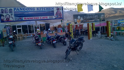
Climax of Hindi film, 3-Idiots, was shot here. Its
impression is seen here in the names of hotels – e.g. Rancho’s Café.

As the evening progressed into night, temperature started to
drop & atmosphere became windy. After dinner, we retired ourselves in the
tents. We didn’t had guts to change our clothes, it was so chilly. I was into 5
layered clothing. We just removed our shoes & slept with all layers on. This
was with two thick blankets / rugs.
We were not able to sleep the whole night; heavy wind was
blowing. The flags over the tents were furling hard causing the heavy Fad-Fad
noise whole night.
At 2.30 am, me and a friend ventured outside as we got bored
by staying awake. The view outside was awesome. There were stars, stars &
stars all around - whole sky was filled with stars. We could see the Milky Way. The
experience was heavenly. I wished I could just stay there watching the view.
However, the chilly wind was taking its toll. Hence we returned inside.
Ride of the day: 163 kms; Total: 1068 kms
Route: Diskit-Khalsar-Agham-Shyok-Darbuk-Tangtse-Pangong
June 4, 2016:
We got up, freshened ourselves… though didn’t wish to. It
was so freezing. Had coffee & just packed our bags on the bikes. There was
no question of bathing or even changing our clothes.
We started by 6.30 am. This was our last destination of
Ladakh trip. We had 3-4 days to go; however, it was now a return journey.
Till Darbuk, we took the same road. In the morning I
realized, there was considerable difference in landscape here. They were a lot
greener. The mountains were still barren, but the plains had green bushes all
over. Yesterday afternoon, maybe I didn’t notice, as I was excited
to see the Pangong Lake & capture my Time-lapse experiment here. I saw a board there mentioning about Marmots (large squirrels, mostly found in mountainous regions). I wished I could see one.
 |
| Changing landscapes - Pangong-Tangtse Road |
 |
| Frozen Lake - enroute Chang La |
 |
| A Walk On The Ice |

We had our tanks full. Normally, people carry Fuel Cans of
5-10 litres here. However, our bikes were giving mileage of about 40 kmpl,
except one. Hence we just carried one Can of 5 litres & couple of water
bottles of 1 litres. We had our lunch & proceeded towards Manali.
We decided to take a halt at Pang, about 140 kms ahead.
Crossing few small villages like Upshi, Gya & Rumtse, we reached the
Tanglang La. This was again much simpler compared to other 3 earlier. The roads
were mostly paved & the view was scenic.

After crossing Tanglang La, the stretch of 50 kms ahead is a
straight road on Plains. The area is called a More (Morey) Plains. It is a colossal
expanse of plain land mass on one side & a mountain range on other. Riding
here was fun. The road was straight; it was plain & well paved. Still were
not able to achieve speed beyond 60-70. Reason, strong wind current was opposing
us. And views were astonishing. We were just wondering that night, how many
cricket stadiums or airports this Plain can accommodate!

 |
| Enroute Tanglang La Top |
 |
| Tanglang La Top |
The Plains end abruptly with rock & sand formations
along Sumkhel Lungpa River. The view is stunning, mostly so, because one never expected such a scene in between this vast land mass. Scanty river water flowing at the
bottom in black while the gold & brown valley rising up on both sides with
natural formations, make you feel how short you are in front of the mighty
nature. The scene is so dramatic that you need to stop for a few minutes for
your mind to absorb it.
After descending for 5 kms over the sandy route with twists
& turns, we reached our destination for the day, Pang. It is said to be
World’s Highest Army Transit Camp at 15,640 feet. It is also a sort of a
camp-site for tourists. It is not a village as such. People don’t stay here
permanently. The locals come here during tourist season for earnings.
 |
| Sumkhel-Lungpa River |
 |
| Pang camp-site below |
 |
| Pang camp-site |
Route: Pangong-Tangtse-Darbuk-Chang
La-Sakti-Karoo-Upshi-Gya-Rumtse-Tanglang La-Pang
June 5, 2016:
We got up at 5. Normally, day rises very early here. By 5.30
am, sun-rays are seen on the ground. As I ventured outside of our tent, I saw
ice formed on my bike-seat. The dew that settled over-night, got freezed due to
sub-zero temperatures.
We started off by 6.30 am. Within couple of hours we crossed
2 back-to-back passes – Lachung La & Nakee La. Next hour, we were at the
Gata Loops. It is a series of 21 hair-pin bends which appear after Nakee La
& descend onto Tsarap River banks, going towards Sarchu. The name is unknown
to many, unless they traversed through this journey. The extreme stomach-churning hair-pin bends
coupled with a steep descend and the loose gravel, make this ride a thrill. By
11 we reached Sarchu, a border point between J&K and Himachal Pradesh.
There is a check-post, where registration has to be done. Sarchu is also a
camp-site for accommodation, similar to Pang.
 |
| Ice formed on the seat - 5.45 am |
 |
| Gata Loops |
 |
| Enroute Baralacha La Top |
 |
| Baralacha La Top |
 |
| Suraj Taal |
 |
| Suraj Taal |
These water crossings are basically due to melting snow.
Hence it is advisable to cross these before 12 noon, as the water flow tends to
increase afterwards. These are mostly located around Zing Zing Bar. This unique
name is for the camp-site on the way, about 20 kms from Baralacha La. There
many such funny names on the way – Whisky Nala (Biskynala), Twing Twing Bar,
Brandy Bridge.


After these Water Crossings, the road is fairly good. The
landscapes & scenes change now, from brown barren & white snow to green
vegetation. The road constantly goes along side the Bhaga River below. Situated
in this lush valley is beautiful town of Jispa. Many staying options are
available. Just 20 kms ahead is another town, Keylong. Stay options are
available here also.
We had planned to make it to Manali, & it was just 4 pm.
Hence we decided to proceed. An important location, Tandi, is just 10 kms
ahead. Important because, it was the first Fuel Pump after 330 kms; and my
Avenger made it without need to top-up.
After petrol fill-up & a tea-break, we started for
Manali – our planned destination. This was our mis-calculation. We thought we
would make it by the day-break – about 100 kms in 3 hours. However, as we
started ascending Rohtang Pass, time just started flying away. At the base on
Rohtang, there is a check-post. Registration is required. The road climbing to
Rohtang is slippery & muddy. By the time we reached Rohtang Top, it was
pitch dark. We started descending in complete darkness. The road, however, was
good; completely tarred & wide enough. But driving in dark was worrisome.
Gradually, the traffic started diminishing – there were absolutely no bikers;
occasional cars & trucks were crossing by. And at a point, we were really
worried in case any mishap happens, or any breakdown strikes. We really feel
now, it was mistake to cover Rohtang at this hour; we should have stayed at
Jispa or Keylong. Next morning, we could have even enjoyed our ride over
Rohtang La, which we missed due to darkness.
 |
| Enroute Manali |
By 10-10:30 pm, we reached at outskirts of Manali. We came
across a hotel, we just stopped over. There was no point in reaching Manali
& searching for a hotel in a crowded hill-station at that hour.
This was our longest kms run of the journey; our most
stretched bike ride of about 16 hours drive; we crossed four major passes &
about the same Water Crossings.
Ride of the day: 315 kms; Total: 1653 kms
Route: Pang-Lachung La- Nakee La -Gata Loops-Sarchu-Baralacha
La-Jispa-Keylong-Tandi-Rohtang La-Manali
June 6, 2016:
Our return flight from Delhi was on 9th night.
Our destination for bike ride was Ambala, from where we had to parcel our bikes
through train & then move to Delhi. We were early by about couple of days –
this was because, we took the short-cut route from Nubra Valley to Pangong
& second, we cancelled our plan for Tsomoriri Lake. We therefore decided to
pre-pone our flight to 8th morning.
Now we had a relaxed time. We decided to leave late since we
had comfortable time to reach Ambala. We slept till late today. Had a lazy
breakfast at 9 & then a fresh bath after 3 days. Post lunch, we started off.
We decided to visit the Hadimba Temple, the main attraction of Manali.
Hadimba Temple is dedicated to the Demon Goddess Hadimba
(Hidimbi). She was the wife of Bheema (from Mahabharata). The temple is located
at a higher elevation in heart of town & main market place of Manali. Main
temple is situated amidst dense Deodar (Cedar) Trees. Vehicular road goes the
parking area near the entrance.
The temple is well-known for its unique, rather unusual,
architectural style. Built like a Pagoda, it consists of 3 square-shaped roofs
with a conical top over it. Majorly it is made in wood, with some carvings over
it. The 4 walls of Sanctum Sanctorum are lined-up with real faces of dead
animals – Deer, Antelopes.
After about ½ an hour, we moved on. The road here onwards
was excellent. Plain tarred road, single lane though (undivided), with
mountainous cliffs on right & the mighty Beas River on left. Riding here was
fun.
We had a coffee break at Kullu. There are options to do
Water Rafting here. We skipped it; in case any of us got injured, who would
drive our bikes? (was the question).
We took a stop-over at Mandi for some Pani Puri & Kulfi
& then moved ahead. We were targeting Rupnagar, which was more than 250 kms
away. However just before Sundernagar, one of our bikes got punctured.
Secondly, there were thunders in the clouds & it felt as if it would rain.
It started getting dark & the road ahead of Sundernagar was pathetic. We
decided to take halt. We came across a hotel on the highway in the hills &
we broke the journey. We were somewhere near the town by the name Hamirpur.
Ride of the day: 151 kms; Total: 1804 kms
Route: Manali-Kullu-Mandi-Sundernagar-Hamirpur
June 7, 2016:
Morning we started at 7 am. This was our last day of riding.
Now, we were at the fag-end of the journey. So far, all these days, it had been
a routine of carrying our baggages till the bikes, tying them up, start riding,
untie it at the destination in the evening & finally carry it to the rooms.
All this would end today.
It started raining whole night; it was, even in the morning.
However, now we had to make it to Ambala Cantonment Railway Station by
afternoon, so that we can book our bikes for Rail Parcel, then move on to Delhi
to catch tomorrow morning flight.
We hence decided to move. Rain was not lashing out… it was
occasional. This time, I covered-up myself with rain gear (Jacket, Rain Pants
& Shoe-Cover). Rain was lashing at some point & it was clear skies
next. After more than a week, we came across 4 & 6 lane highway. By the
time, we neared Chandigarh climate again changed to bright sunny & hot.
By 1 pm we reach Ambala Cantt Station.
Ride of the day: 206 kms; Total: 2010 kms
Route: Hamirpur-Rupnagar-Chandigarh (bypass)-Ambala Cantt
Hereon, we proceeded for parcel formalities. Again the same
old Govt. Bureaucratic Story. We completed all the processes by 5 pm. We skipped
lunch due to this, as this was important.
After all our bikes were handed over, we hired a Taxi for
Delhi. On the way had some heavy South Indian snacks & reach New Delhi
Airport by 11 pm. We had booked a hotel near the Airport.
June 8, 2016:
At 6 am we checked-out & moved to the Airport. This was
the final leg, the last day of an EPIC JOURNEY. Within few more hours, we were
back to the comforts of our homes.
Odo Readings:
Jammu 0 kms
Udhampur 50 kms
Batote 125 kms
Srinagar 300 kms
Kargil War Memorial 455 kms
Kargil Town 520 kms
Lamayuru 620 kms
Nimmu 700 kms
Leh 751 kms
Khardung La Top 791 kms
Diskit 890 kms
Hunder 897 kms
Shyok 967 kms
Tangtse 992 kms
Pangong Tso 1068 kms
Sakti 1168 kms
Karu 1183 kms
Pang 1323 kms
Tandi 1513 kms
Manali 1653 kms
Hamirpur 1804 kms
Ambala Cantt 2010 kms
Few Tips:
- Carry original documents - Personal ID as well as Vehicle Papers (Driving License, RC, TC, PUC & Insurance). Also, keep two photo-copies of each.
- Start early - this ensures you reach your destination in time & takes care of time losses due to traffic jams, roads closed, breakdowns.
- AMS (Acute Mountain Sickness) is not any demon; you just need to be careful & take precautions. AMS symptoms are headache, vomiting, dizzyness
- Consult your Family Doctor for any special precautions.
- Carry a Diamox tablet, however it is not mandatory to take it; you may avoid it unless the symptoms are unbearable.
- Carry Camphor (Kapur) along & just smell it if you feel dizzy (Bheem-seni Camphor is preferred).
- Carry a Homeopathic medicine - COCO.
- Actually we didn't feel AMS while riding. It is felt if you stop. Do not spend more than 10 minutes on Passes Tops.
- Keep one rest-day at Leh; if landing directly in Leh through Flight, keep two rest-days for acclimatization.
- Riding / driving from Jammu to Leh is easier as ascend is gradual; from Manali to Leh is difficult due to sudden ascend (from 6000 feet to 15000 feet).
- Carry a basic Medical Kit & essential medicines as per requirement.
- Carry pouches of Electral or Glucose or alike to avoid dehydration.
- Connectivity can be a problem. Only BSNL & to some extent Aircel Network is available. If possible, carry a BSNL Postpaid Sim. Also, only Postpaid connections work in J&K. Pre-paid Sims of any Network are of no use.
- Wi-Fi is abundantly available in all major towns. All hotels provide free Wi-Fi. In Leh, even Restaurants provide it.
- Dressing - no need for any special costly riding jackets (however, they are definitely useful if available).
- Layered clothing can be used; only required clothes to be put on.
- Body Warmer (Thermals) are useful.
- Rain Wear to be carried as weather is undependable. Shoe Covers are available which protect shoes & socks getting wet due to rain & in Water Crossings & Loggings.
- Wear a Leather Jacket as the area is extremely dusty. Avoid woolens.
- Helmet is obvious - have a Goggle (UV filter & polarised) and a Balaclava or Face Mask.
- Have basic guards - Knee Guard, Elbow Guard.
- Sun-screen lotion - Climate is cold & chilly, however Sun is strong
- Self-declaration Forms - required during passing Khardung La. They are available at hotels in Leh. At other check-posts, only registration is required. While coming from Manali to Leh, registration is required to cross Rohtang La
- Taxi Unions are strong in the Region. Only J&K registered Taxis are allowed to ply on interior roads for Pangong Lake & Nubra Valley. In case you are coming by Self-driven Vehicles (like Zoom Cars), you can drive through the main highways only (Srinagar-Leh & Leh-Manali). To visit Nubra & Pangong, you need to hire a Taxi or Bike.
- Credit Cards are absolutely useless in Ladakh. Cash to be carried. Rs. 5000 is sufficient at any point of time; however, Rs. 10000 is safer. ATMs are available at Srinagar, Kargil, Leh, Manali. ATMs also available in 2-3 smaller towns, however not sure about cash availability.
- Toilets are hardly available on the way. No problem in bigger towns; however on the way or at Pangong, Pang, Sarchu (camp-sites), it can be a problem. Only enclosures on four-sides with open to sky toilets are available. At some places, cleanliness can be an issue.
- Lastly, remember that you are here for RIDING & not RACING. Do not try to do any off-roading or stunts. Enjoy the view instead.
Stay details:
Thanks for provide the Ladakh Landscapes to get joined the June 2016. Taj Mahal Tour By Car or by train travel information.
ReplyDeleteOh God! i really enjoy to reading of this blog which provides the Leh Ladakh Landscapes of this month and now i have planning to India. Golden triangle tour 6 days and 7 nights booking the best tour with family.
ReplyDeleteGood Blog you right! I appreciate your work.Visit India MotorBike tours! and Experience the real Himalaya Tours by Road Trip.
ReplyDeleteLadakh is a pilgrim’s paradise. Furthermore, regardless of whether you’re not a predictable trekker, there are some casual courses that you can do, since this is an incredible method to investigate Ladakh desert.
ReplyDeleteBeautiful place.
ReplyDeleteforums.perforce.com